← Back to Module 10
ITS ePrimer Presentation
Module 10: Rural and Regional ITS Applications
(Note: The following PowerPoint presentation is a supplement to the module.)
Slide 1: ITS ePrimer Module 10: Rural and Regional ITS Applications

September 2013
Intelligent Transportation Systems Joint Program Office Research and Innovative Technology Administration, USDOT
Author Notes for Slide 1:
This is the first, title slide in all modules.
The following slides are in this order:
- Instructor
- Learning Objectives
- Content-related slide(s)
- Summary (what we have learned)
- References
- Questions?
This module is sponsored by the U.S. Department of Transportation's ITS Professional Capacity Building (PCB) Program. The ITS PCB Program is part of the Research and Innovative Technology Administration's ITS Joint Program Office.
Thank you for participating and we hope you find this module helpful.
Slide 2: Instructor

Source: Western Transportation Institute
Steve Albert
Director
Western Transportation Institute (WTI)
Montana State University (Bozeman, MT, USA)
Author Notes for Slide 2:
Steve Albert: Director at WTI for more than 17 years.
Albert and WTI considered pioneers in field of deploying ITS in rural environments.
Albert a national spokesperson on rural transportation issues: testified before Congress three times; serves on USDOT Joint Program Office ITS Program Advisory Board.
Slide 3: Learning Objectives
You will learn to:
- Identify rural transportation needs.
- Select ITS initiatives that can be integrated regionally.
- Apply lessons from successful case studies.
- Support rural and regional transportation initiatives.
Author Notes for Slide 3:
You will learn to:
- Identify the unique transportation needs in rural areas and the challenges of deploying ITS in a rural setting.
- Identify and select ITS initiatives that can be integrated and applied at the regional and/or multistate level.
- Apply lessons from the examples of successful ITS deployment for use in other locations.
- Articulate the value of addressing rural and regional needs, and apply this knowledge to support rural and regional transportation initiatives.
Slide 4: Module Overview
This module will address the following topics:
- The rural transportation network: challenges and needs
- ITS technologies and projects
- Case study examples
- Regional ITS: coordination, architecture and planning
- Multistate coordination initiatives: corridor coalitions
- Vision for the future
Author Notes for Slide 4:
This presentation begins with overview of the unique issues and user needs in a rural environment.
It presents types of ITS technologies and projects used in rural areas, as well as three more detailed case study examples.
It also provides an overview of regional ITS planning and multistate corridor initiatives, concluding with ITS vision and goals for the future.
Slide 5: The Rural Transportation Network
Rural areas contain:
- 3/4 of the nation's roads
- 3 million miles of roadway
Rural travel is a key component of a comprehensive national network
ITS deployments can improve safety and mobility
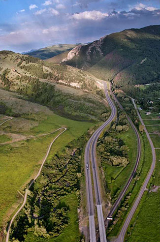
Source: Western Transportation Institute
Author Notes for Slide 5:
The nation's transportation network is an integrated system with each segment— rural and urban—necessary to the whole.
People, goods, and services must be able to reach every corner of the country safely and efficiently.
Rural transportation services and facilities should be maintained and enhanced at an equivalent level as their urban and suburban counterparts.
Improving rural transportation is more than transferring urban policies and solutions to a less populous environment.
Rural areas have different technological infrastructure, fiscal resources, infrastructure usage, and travel patterns.
Practitioners must understand the unique needs, conditions, and constraints of travel in rural areas.
Slide 6: The Rural Transportation Network
However…
Transportation policy and funding focus on urban areas.
Enhancements and new technologies, including ITS deployments, do not reach large segments of the U.S.
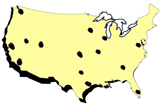
(Extended Text Description: This is an illustration of America's "Swiss Cheese" approach. It is an pale yellow map of the United States with a black border. Medium black circles have been scattered over various parts of the map to represent holes similar to Swiss cheese. For additional relevant information about this graphic, please see the Author Notes below.)
America's "Swiss Cheese" approach to transportation development (graphic by the Western Transportation Institute)
Author Notes for Slide 6:
To understand the impact of traditional transportation policy on rural America, it is helpful to visualize a slice of Swiss cheese.
Urban areas are the random "holes" across the landscape that attract most of the attention (and often funding).
Rural areas are the large tracts of solid mass in between that do not stand out, but are essential to holding the cheese together.
Addressing rural transportation needs helps to enhance the "whole" transportation system, rather than just the "holes."
This approach would support the development of a complete, integrated, seamless transportation infrastructure.
Slide 7: Audience Question
Why is rural travel challenging?
Author Notes for Slide 7:
Can you name a few reasons why travel though rural areas may be more challenging for drivers than travel through suburban and urban areas?
Slide 8: Why Is Rural Travel Challenging?
- Alignments and terrain
- Slow vehicles
- Obstacles
- Severe weather
- Unfamiliar drivers
- Communication gaps
- Long distances
- Slow emergency response
- Few alternative routes
Source: Western Transportation Institute
Author Notes for Slide 8:
Rural roads account for 80% of the national road network and carry about 40% of vehicle miles traveled.
However, driving on rural roads can be very different and more challenging than driving in urban and suburban areas:
- Rural roadways often have more severe alignment features due to varied terrain (curves, mountain passes)
- Slow-moving vehicles (e.g., farm equipment) and truck traffic are frequently encountered in the traffic stream
- Unexpected obstacles (e.g., animals)
- Poor weather/visibility
- Tourists unfamiliar with rural driving conditions
- High population of aging residents
- Communication/technology limitation (e.g., gaps in cell phone coverage)
- Slow emergency response due to long distances between towns
- Few alternative routes cause major delays after an incident
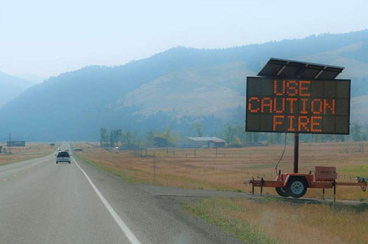
Slide 9: Rural Transportation: Challenges and Needs
Safety On rural roads…
- 57% of road fatalities
- 57% of alcohol fatalities
- 89% of wildlife collisions
- Slower emergency response (50% longer)
ITS can help with…
- Safety/weather alerts
- Delay notifications
- Incident response
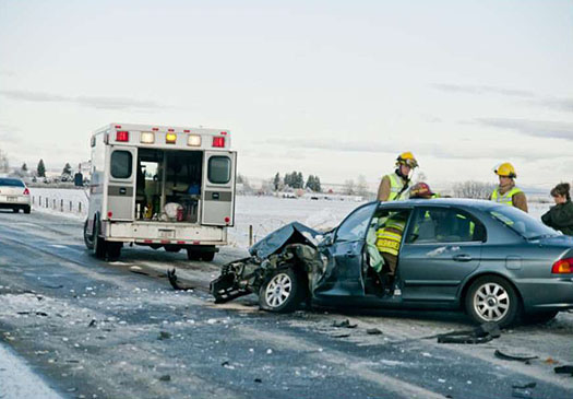
(Extended Text Description: This is a photo of an emergency response team at the scene of an automobile collision. Snow and ice cover the flat landscape. In the center of the photo, is a paramedic vehicle. In the foreground of the image, is a blue four-door sedan. The front of the car is severely damaged. Three paramedic workers are at the scene, one appears to be inside the car.)
Source: Western Transportation Institute
Author Notes for Slide 9:
Traveling in rural areas presents a disproportionate risk of severe injuries and fatalities (as described in the statistics in the slide).
Rural America does not have the same type of mobility issues and recurring congestion as urban areas.
Rural areas do however have nonrecurring congestion and mobility issues as a result of weather, construction, incidents, and special events.
These safety and operational challenges can be addressed with ITS applications.
Slide 10: Rural Transportation: Challenges and Needs Public Transportation and Mobility
- Small fleets
- Infrequent service
- 38% of rural residents have no access to public transportation
ITS can help with
- Schedules and route optimization
- Coordination of resources
- Information dissemination
Author Notes for Slide 10:
In urban areas, public transportation is often viewed as a means of reducing congestion.
In rural areas, public transportation is viewed as a "lifeline," providing access to jobs, stores, and medical services in larger, nearby communities. However, approximately 38% of the rural population has no access to public transportation.
Existing service is sometimes restricted to weekdays, with service often operating from 8 a.m. to 4 p.m., or even fewer hours per day.
Priority mobility issues include:
- Expanding access to information about schedules and routes;
- Raising public awareness of existing transit services; and
- Facilitating service coordination among multiple agencies.
Slide 11: Rural Transportation: Challenges and Needs
Infrastructure
- 40% of county roads not maintained
- Severe weather limits mobility
- Maintenance difficult, expensive
- Few alternate routes
ITS can help with
- Infrastructure monitoring
- Work zone management and safety
- Weather information dissemination
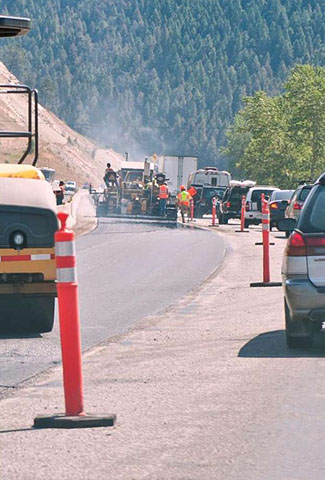
(Extended Text Description: This is a photograph of road construction taking place on a mountain road. On the left side of the photo are road construction vehicles and a work crew in the distance. There are tall portable orange divider markers with two white stripes at the top that separate the road. To the right of the orange lane markers is passing traffic made up of a long line of cars. An evergreen covered mountainside can be seen on in the background.)
Source: Western Transportation Institute
Author Notes for Slide 11:
Rural transportation agencies manage and maintain 80% of the national road network.
Challenges include:
- Small populations limit local resources available for construction, operation, and maintenance of facilities.
- Long distances between towns and cities make it expensive to deploy and monitor infrastructure enhancements.
- Many rural areas are subject to severe weather conditions, which decrease longevity of facilities and limit mobility.
- Road closures during severe weather can have a great impact on travel.
- Lack of alternative routes. Road closures can have a significant impact on both rural and non-rural residents.
Slide 12: Rural Transportation: Challenges and Needs
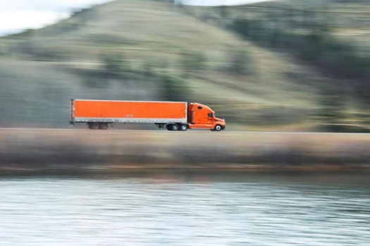
Global Connectivity
Rural interstates = coast-to-coast goods transport.
Commercial traffic is increasing
ITS can help with
- Weigh station operations
- Real-time road conditions
- Safety warnings for large vehicles
Source: Western Transportation Institute
Author Notes for Slide 12:
The movement of goods is critical to the economy of the United States.
Rural interstates are the arteries that allow goods to flow throughout the country.
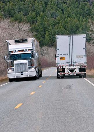
On many rural highways, 30% of traffic is commercial vehicles, and their numbers continue to grow.
Commercial vehicle operators have identified several transportation needs associated with rural travel:
- The frequency with which they must stop at weigh stations for verification of permits, load limitation checks, and safety inspections.
- Lost time and money due to length of these stops.
ITS enhancements at weigh stations can make operations more efficient and reduce travel delays.
ITS enhancements related to road weather systems can enhance the availability of real-time road conditions.
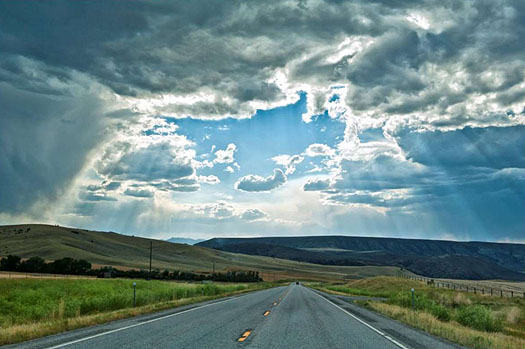
Slide 13: Rural Transportation: Challenges and Needs
Travel and Tourism
Key to rural economic development
1 of 8 jobs is tied to tourism
ITS can help with
- Real-time traveler information
- Congestion and parking
- Regional information dissemination
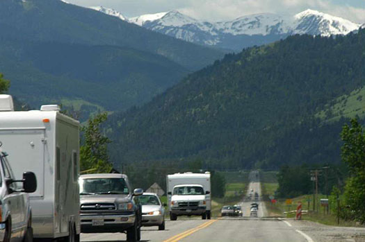
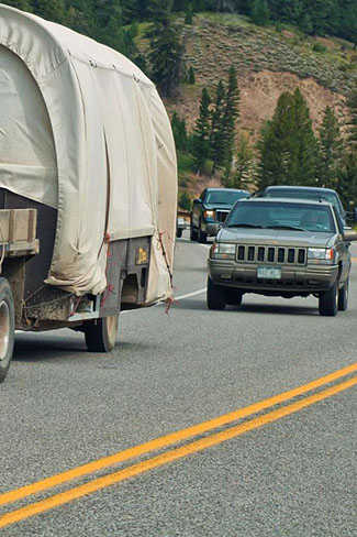
(Extended Text Description: This is a photo of traffic on a straight rural road in the mountains of the US. The line of traffic begins on the left with a white pick-up truck pulling a small camper. Behind it is a line of cars and trucks that continues until the road is no longer visible. In the background are tree-covered hills, and snow-capped mountains can be seen in the distance.)
Source: Western Transportation Institute
Author Notes for Slide 13:
Tourism is a critical concern to the economic viability of numerous rural communities.
In 2011, travel and tourism in the United States were among the top 10 industries in terms of employment in 48 states.
The Western Transportation Institute, in partnership with FHWA and the travel and tourism community, conducted rural ITS outreach workshops in 15 states to identify priority transportation issues affecting tourism. Stakeholders identified the following priorities:
- Directional signing;
- Timely and accurate information;
- Coordination of traffic management alternatives;
- Seasonal and special event traffic management;
- Parking information;
- Regional sharing of information and services; and
- Funding.
Slide 14: Rural Transportation: Challenges and Needs
Public Lands and Tribal Lands
Balance access and resource preservation.
Enhance tourism and safety
ITS can help with
- Real-time traveler info
- Congestion and parking
- Tourism information
- Multimodal options
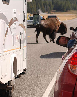
(Extended Text Description: This is a photograph of stopped traffic due to a bison crossing the road. In the foreground of the photo is an RV on the left, the left rear of sedan vehicle on the right. In the center of the photo is a bison crossing the road. Behind the bison are two more cars coming from the opposite direction waiting for the bison to pass.)
Source: Western Transportation Institute
Author Notes for Slide 14:
Many public land units (national parks, forests, and recreation areas) are located in rural areas.
Public land managers are challenged to provide effective and appropriate transportation between gateway communities and public lands.
Public land managers must also balance visitor access and experience issues with resource preservation and maintaining character of land unit.
Priority transportation issues for public lands and gateway communities include:
- Congestion management;
- Traveler information;
- Parking management;
- Integration/coordination with regional transportation networks; and
- Multimodal transportation development (including bicycle and pedestrian facilities).
On Native American lands, safety, economic viability, and transportation are key issues:
- According to crash data, Native Americans die in motor vehicle crashes at rates six times higher than the national average.
- Unemployment rates on reservations often exceed 70%, more than 10 times the national rate.
- Only 29% of tribes have any form of transit system.
In a survey of 300 tribes, respondents identified economic viability as the most important tribal transportation issue.
Safety needs were second priority, followed by tourism, and traveler information.
Slide 15: Rural Transportation: Challenges and Needs
Sustainability
- Air and water resources
- Wildlife and habitats
- Manage growth
- Preserve rural character
ITS can help with
- Animal/vehicle collisions
- Transportation planning
- Green practices

Source: Western Transportation Institute
Author Notes for Slide 15:
In urban areas, environmental sustainability issues related to transportation focus on:
- Air and water resources;
- Congestion management; and
- Growth management.
Rural areas face some of these issues, plus additional challenges:
- Preserving the rural character of the region;
- Preserving forests, rivers, and other resources adjacent to roadways; and
- Preserving wildlife populations and habitats.
For example, wildlife-vehicle collisions (WVCs) have a significant impact on human safety, property, and wildlife.
These collisions affect rural areas more directly, as 89% of wildlife-vehicle collisions occur on two-lane roads.
Slide 16: ITS Technologies and Projects
FHWA's 7 Critical Program Areas:
- Categorize principal rural transportation challenges
- Describe applicable ITS technologies
Source: Western Transportation Institute
Author Notes for Slide 16:
Rural transportation issues are multifaceted and generally cannot be solved by a single strategy.
The Federal Highway Administration developed seven Critical Program Areas (CPAs), in order to:
- Categorize principal rural transportation challenges; and
- Describe ITS technologies that may be applicable and beneficial in the development of solutions.
FHWA developed these CPAs through rural outreach sessions and focus groups conducted in numerous rural communities.
This section of the presentation describes ITS technologies and projects used or applicable to rural transportation.
The projects and technologies are categorized and presented in terms of the following 7 CPAs.
Slide 17: ITS Technologies and Projects
Critical Program Area #1:
Traveler Safety and Security
ITS Technologies and Projects:
- Dynamic Speed Warning Systems
- Intersection/Crash Warning Systems
- Lane Departure Systems
- Hazardous Road
Conditions
Source: Western Transportation Institute
Author Notes for Slide 17:
This CPA addresses the need to:
- improve a driver's ability to operate his vehicle in a safe and responsible way, and
- improve driver notification of potentially hazardous driving conditions (e.g., poor road conditions, reduced visibility, obstructions, or animals).
Example projects in this CPA may include:
- Dynamic speed warning message signs;
- Intersection advance warning signing;
- Animal-vehicle alert warning systems;
- Lane departure alerts; and
- Road sensors that trigger warning signs based on driver behavior (e.g., Speeding).
Slide 18: ITS Technologies and Projects
Critical Program Area #2:
Tourism and Traveler Information
ITS Technologies and Projects:
- 511 Traveler Information Systems
- Road/Weather Condition Alerts
- Intersection/Crash Warning Systems
- Real-time Parking Signage
- Regional Tourism Information Systems
Source: Western Transportation Institute
Author Notes for Slide 18:
This program area includes methods to provide traveler information and mobility services to travelers unfamiliar with the area.
Example projects in this CPA may include:
- Area-wide dissemination of information regarding weather and road conditions via radio, computers, television, or cell phone applications.
- Real-time information to tourists about road conditions, parking availability, or construction projects.
- Regional servers that consolidate tourism service information such as lodging and special events and disseminate it to the traveling public via highway advisory radio systems, kiosks, or other communication technologies.
Slide 19: ITS Technologies and Projects
Critical Program Area #3:
Infrastructure Operations and Maintenance
ITS Technologies and Projects:
- Road Weather Information Systems on Infrastructure
- Weigh-in-motion Sensors
- CCTV Condition Monitoring
- Automated Gate Closures
- Work Zone Safety Systems
- Snowplow In-vehicle Technologies
Source: Western Transportation Institute
Author Notes for Slide 19:
This CPA addresses efficient and effective maintenance and operation of rural roadways and infrastructure to address challenges such as:
- Responding to changing weather conditions;
- Coordinating response activities;
- Managing construction and work zones; and
- Automating maintenance activities.
Example projects may include:
- Road-weather information systems;
- Weigh-in-motion sensors;
- Closed circuit television cameras;
- Automated gate closure systems;
- Work zone speed control and alert systems; and
- In-vehicle technologies (e.g., to facilitate snowplow operations).
Slide 20: ITS Technologies and Projects
Critical Program Area #4: Emergency Services
ITS Technologies and Projects:
- Mayday systems
- Emergency fleet tracking systems
- Apps to collect/disseminate data to remote locations
Source: Western Transportation Institute
Author Notes for Slide 20:
This program area focuses on:
- Providing improved notification and emergency response when an incident occurs;
- Reducing the time to notify the appropriate emergency service provider(s); and
- Providing additional crash details to enable appropriate, efficient responses.
Example projects in this CPA may include:
- Mayday systems;
- Hotline call-in programs; and
- Emergency fleet management tracking systems.
Emerging technologies include custom applications that facilitate collection and dissemination of data from remote locations.
Slide 21: ITS Technologies and Projects
Critical Program Area #5: Public Mobility Services
ITS Technologies and Projects:
- Automated Vehicle Location Systems
- Computer-assisted Scheduling/Dispatching
- Advanced Fare Collection Systems
- Automated Ride Sharing Systems
Author Notes for Slide 21:
This CPA addresses the accessibility and coordination of public transportation services to rural residents or travelers.
Sample projects include:
- Systems that allow transit vehicles to be pre-cleared through congested areas
- Electronic fare payment systems for easy boarding
- Automatic vehicle identification and location systems
- Computer-assisted scheduling and dispatching
- Automatic telephone information systems
- Enunciator systems
- Dynamic on-demand transit dispatching
- Automated ride-sharing services
Slide 22: ITS Technologies and Projects
Critical Program Area #6: Fleet Management
ITS Technologies and Projects:
- Automated Vehicle Location Systems
- Vehicle/Engine Monitoring Systems
- Connected Vehicle Systems to Collect Data
Author Notes for Slide 22:
This CPA addresses efficient scheduling, billing, routing, locating, and maintaining of rural fleets.
Example projects in this CPA may include:
- Automatic vehicle location systems;
- Vehicle and engine monitoring systems; and
- Connected vehicle technologies for probe data collection projects that collect, process, and transfer field data to operations managers.
Slide 23: ITS Technologies and Projects
Critical Program Area #7: Commercial Vehicle Operations
ITS Technologies and Projects:
- Automated Vehicle Location Systems
- Weigh Station Systems
- Hazardous Material Identification
- Driver Monitoring
Source: Western Transportation Institute
Author Notes for Slide 23:
This CPA addresses the regulation, management, and logistics of commercial fleet operations.
Sample projects could include:
- Hazardous material identification;
- Driver monitoring;
- Rural addressing; and
- Enforcement and management efforts.
Slide 24: ITS Technologies and Projects
Multimedia Examples
Safety and Security (Emergency Response):
The "Redding Responder System" in California collects and shares information from remote locations. See video here: http://www.westernstates.org/Projects/Responder/History/Default.html#VIDEO
Traveler Information:
Virginia DOT has an integrated, statewide 511 system: https://www.youtube.com/watch?v=mPJhyfoMHcw
Author Notes for Slide 24:
For additional examples of deployed ITS technologies and projects, here are links to two videos on innovative/notable projects that use technologies discussed in this section.
Slide 25: Case Study 1: Wind Warning System
U.S. Highway 101/Yaquina Bay Bridge (Oregon Coast)
Goal: warn drivers to stop or take alternate route during high wind conditions
System: wind gauges, message signs, flashers, automatic TOC notification, ODOT Web site
Benefits:  traffic delays; benefit cost ratios of 4:1 on highway; 22:1 on bridge
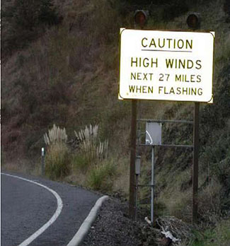
Source: Western Transportation Institute
Author Notes for Slide 25:
The Oregon Department of Transportation (ODOT) conducted evaluations of automated wind warning systems (AWWS) at two sites:
- Coastal segment of US Route 101
- Yaquina Bay Bridge (also on U.S. Route 101)
The system was designed to warn drivers to pull over (stop) and wait until conditions improved, or take an alternate route.
Wind gauges (anemometers) were connected to roadside static message signs.
Flashers where activated when average wind speeds reached predetermined threshold levels.
The system automatically recorded the severity of the crosswinds and notified traffic operators of system status.
The Traffic Operations Center (TOC) verified the conditions and posted additional warnings on the ODOT TripCheck Web site.
The benefit-to-cost ratios for the South Coast system and Yaquina Bay Bridge system were 4.13:1 and 22.80:1, respectively.
The Yaquina Bay Bridge system had a higher ratio, reflecting the higher frequency of crosswinds in the area and heavier traffic volumes.
The analyses assumed the system would reduce delays by approximately 20%.
Slide 26: Case Study 2: Island Explorer Transit ITS
Acadia National Park (Maine)
Goal: Enhance transit system
System: AVL, real-time departure times, "Next Bus" automated signs, communication systems
Benefits:
- 80% of visitors: "System easier to use"

Source: John Daigle, University of Maine
Author Notes for Slide 26:
In 1999, Acadia National Park (ANP) and partners created the Island Explorer System to provide transit routes that link hotels and businesses with destinations in the park.
In 2002, ANP implemented many ITS technologies to enhance the transit system:
- Two-way communication
- Automatic Vehicle Location (AVL) for buses
- Automated annunciator for onboard messages
- Next bus stop displayed on electric sign in bus
- Real-time departure times on electronic message signs at select bus stops
- Automated passenger counters
- Real-time parking conditions
- Park entrance traffic recorders
Operational benefits for personnel: facilitates communication, scheduling, location monitoring, and system usage tracking.
Visitors: according to surveys, 80% said upgrades like electronic arrival/departure signs made the system easier to use.
Slide 27: Case Study 3: Traveler Information System
Grand Canyon National Park (Arizona)
Goal: Provide shuttle info to visitors
System: PDMS and HAR
Benefits:
- 45% increase in shuttle use
 fuel savings
- vehicle miles driven
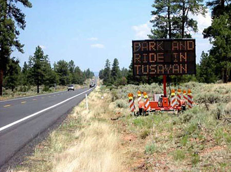
Source: Western Transportation Institute
Author Notes for Slide 27:
In 2008, the Grand Canyon National Park (GRCA) conducted a pilot shuttle bus program, to offer car-free travel from Tusayan, Arizona, to the Canyon View Information Plaza.
A key component of the program was a traveler information system to provide shuttle use information to visitors.
The information system was deployed in the cities of Valle and Tusayan, consisting of:
- one Portable Dynamic Message Sign (PDMS),
- two Highway Advisory Radio (HAR), and
- two HAR static signs.
Evaluation results: the presence of the PDMS and HAR strongly increased visitor ridership:
- The traveler information system added 368 shuttle passengers per day.
- Produced an increase of 45.7 percent in shuttle ridership over that without the PDMS and HAR.
The traveler information system supported the goals to alleviate traffic and parking congestion at the GRCA during the summer peak season.
Slide 28: Regional ITS Coordination
Why coordinate regionally?
- New technologies facilitate integration of systems
- National ITS Architecture and recent policy encourages regional coordination
- Regional ITS plans can enhance benefits of rural ITS deployments
Author Notes for Slide 28:
Rural ITS usually focuses on addressing issues at spot locations.
ITS also provides opportunities to deliver safer and more efficient transportation services at a larger geographic scale (i.e., regional, statewide). Many of these new opportunities are predicated upon effective coordination between organizations—at both institutional and technical levels.
The USDOT developed the National ITS Architecture to help identify and leverage these opportunities for cost-effective cooperation.
This section introduces concepts and guidance related to regional ITS coordination.
Slide 29: Regional ITS Architecture
FHWA Guidance
FHWA created a process for establishing a regional ITS architecture
Guidance document:
Regional ITS Architecture Guidance: Developing, Using and Maintaining an ITS Architecture for Your Region (FHWA, 2006)
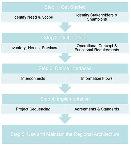
(Extended Text Description: This flowchart represents the FHWA process for establishing a regional ITS architecture. Starting at the top, there is a box labeled "Step 1: Get Started." In that box, the action items noted are "Identify Need & Scope" and "Identify Stakeholders & Champions." From the bottom of that box, an arrow points down to a second box labeled "Step 2: Gather Data." Action items noted in this box are "Inventory, Needs, Services" and "Operational Concept & Functional Requirements." From this box, and arrow points down to a third box labeled "Step 3: Define Interfaces." Action items noted in this box are "Interconnects" and "Information Flows." From this box, an arrow points down to a fourth box labeled "Step 4: Implementation." Action items notes in this box are "Project Sequencing" and "Agreements & Standards." From the bottom of this box an arrow points down to the final box, labeled "Step 5: Use and Maintain the Regional Architecture.")
Source: Graphic based on FHWA, 2006
Author Notes for Slide 29:
FHWA has produced an excellent reference document as a guide for transportation professionals: Regional ITS Architecture Guidance: Developing, Using, and Maintaining an ITS Architecture for Your Region.
The document:
- Describes a process for creating a regional ITS architecture with supporting examples of each architecture product;
- Presents an approach for mainstreaming ITS into the transportation planning and project development processes; and
- Discusses maintenance of the architecture.
The guidance is structured around the process shown in the graphic in this slide.
Slide 30: Regional Project Selection
Sample Approach
- Examine problems
- Map to regional goals
- Identify projects
- Short-term
- Medium-term
- Long-term
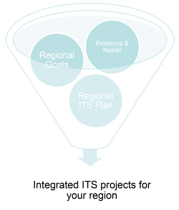
(Extended Text Description: This graphic represents a sample approach to identifying integrated ITS projects for your region. In the graphic, there is a large three-dimensional funnel. Inside the funnel there are three large circles. Each circle is labeled as followed: Regional Goals, Problems & Needs, and Regional ITS Plan. At the narrow base of the funnel is an arrow pointing down to the words "Integrated ITS projects for your region.")
Author Notes for Slide 30:
With a regional architecture in place, transportation professionals can use it to guide project planning and selection.
One approach to identifying projects and developing a set of integrated ITS projects is to:
- Examine specific transportation problems;
- Map them to regional goals and objects; and
- Identify a set of project short-term, medium term, and long-term projects (as shown in the graphic in this slide).
Slide 31: Rural ITS Architecture
Regional ITS planning may incorporate multiple rural ITS architectures
Rural architectures can be framework for multimodal integration
ITS applications often selected to solve problem at "hot spot" location
| Area |
Sample Challenges |
| Safety |
Poor Alignment RR Grade Crossing
Snow/Ice on Road Construction |
| Freight |
High Truck Traffic |
| Incident Response |
Incident Response Time |
| Mobility |
Congestion/Delays
Transit Availability |
| Tourism |
Traveler Information |
| Environment |
Wildlife Conflicts |
| Infrastructure |
Road/Weather Condition Monitoring |
Author Notes for Slide 32:
Regional ITS planning may encompass:
- Cities and counties within a geographic area;
- The gateway communities surrounding a national park; or
- The jurisdictions that border a transportation corridor.
Within the regional planning context, there may be one or more rural ITS architectures.
A rural ITS architecture can serve as a framework for the development of multimodal integrated transportation systems.
Typically, ITS applications in a rural setting have been selected and designed to solve an individual problem at a single "hot spot" location (e.g., a blind curve with a high incidence of crashes).
ITS technologies have been applied to a variety of complicated issues (see examples in the table on this slide).
Slide 32: ITS Strategic Planning Process
Modified ITS Strategic Planning Process
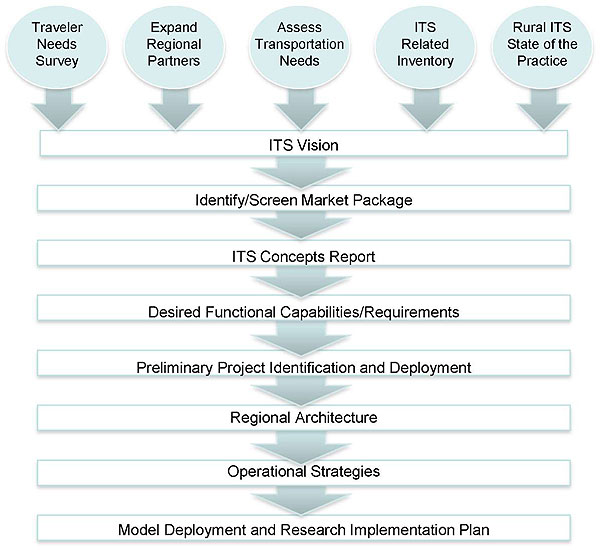
(Extended Text Description: This flowchart represents the Modified ITS Strategic Planning Process as represented by the Western Transportation Institute. The flowchart begins at the top of slide. In a single row going across the slide are five circles labeled the following: Traveler Needs Survey, Expand Regional Partners, Assess Transportation Needs, ITS Related Inventory, and Rural ITS State of the Practice. Each circle has an arrow at the bottom of the circle pointing down to a common horizontal bar labeled "ITS Vision." The ITS Vision" bar is the top level of eight bars that are stacked vertically down the slide. Each bar has a downward pointing arrow that leads to the next level or step in the process. From top to bottom, the steps in the ITS Strategic Planning Process are arranged in the following order: ITS Vision, Identify/Screen Market Package, ITS Concepts Report, Desired Functional Capabilities/Requirements, Preliminary Project Identification and Deployment, Regional Architecture, Operational Strategies, and Model Deployment and Research Implementation Plan.)
Source: Western Transportation Institute
Author Notes for Slide 32:
To develop a rural ITS architecture and a strategic plan, local leaders and transportation professionals should begin with a strategic planning process that:
- Quantifies the multimodal needs of the traveling public;
- Leverages regional partnerships; and
- Builds on the success of legacy projects and systems.
This is a key component in selecting and prioritizing effective and sustainable projects.
Slide 33: Stakeholder Participation
Rural/regional stakeholders add value:
- Identify challenges/needs
- Secure local resources
- Provide specialized expertise
- Act as champions
| Category |
Potential Partners |
| Federal Agencies |
USDOT
Resource (NPS/USFS)
Weather Service |
| State Agencies |
DOTs
Commerce/Econ Dev.
Highway Patrol
Dept of Tourism |
| Local/Regional |
Planning Orgs
Chambers of Commerce
Emergency Response |
| Tribal |
Regional Orgs
Individual Tribes |
| Private Sector |
Transit Operators
Fleet Operators
Concessionaires |
Author Notes for Slide 33:
In rural areas, stakeholders can provide valuable input regarding local challenges, user needs, and available resources.
However, some may not immediately recognize the importance of transportation in efforts to address community or regional challenges. Transportation leaders may have to take the lead in identifying and inviting representatives from a broad range of organizations.
Rural stakeholders represent a variety of public and private entities, each with their own interest in how transportation supports their needs. Stakeholders may also bring specialized expertise or resources to the table that may assist with ITS development and deployment.
Examples of key stakeholders are listed in the table in this slide.
NPS = National Park Service
USFS = United States Forest Service
Slide 34: Coordination and Data Exchange
GIS Tools
Geographic Information Systems (GIS) can be used for:
- Problem identification and scale
- Legacy system inventory
- Potential deployment
| Geographic Information Systems |
| Transportation Data |
| Traveler Characteristics |
| Weather Data |
| Animal Migration Patterns |
| Communication Infrastructure |
| Administrative/Transportation Facilities |
| Existing Transportation System |
| Planned Transportation System |
| Potential Advanced Technologies |
Author Notes for Slide 34:
The most common issues faced by rural communities are not technological but institutional in nature.
Rural communities are challenged by the issues of communication, cooperation, and coordination.
Rural areas typically do not have a metropolitan planning organization or a regional transit agency to facilitate or oversee cooperative efforts.
GIS tools assist in:
- Identification of problems;
- Identification of problem scale (e.g., Corridor-wide vs. Hot spot location);
- Documentation of legacy systems; and
- Identification of potential deployment locations.
Slide 35: Coordination and Data Exchange
Architecture
Architecture defines:
- Communication systems
- Transportation
- Institutions
- Interfaces
- Recommendations
- Objectives and requirements
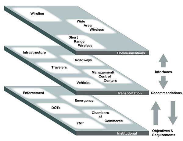
(Extended Text Description: This is an illustration of the National System Architecture. This architecture helps to define the interfaces and system requirements. There are three layers of the graphic. The top layer is labeled "Communications." The middle layer is labeled "Transportation." The bottom layer is labeled "Institutional." Each layer has topics that need to be considered during the planning process. These are identified in white boxes. On the top "Communications" layer, the areas of consideration are: wireline, wide area wireless, and short range wireless. On the middle "Transportation" layer, the areas of consideration are: Infrastructure, Travelers, Roadways, Vehicles, and Management/Control Centers. On the bottom "Institutional" layer, the areas of consideration are: Enforcement, Emergency, DOTs, YNP, and Chambers of Commerce. In between and to the right of the "Communication" and "Transportation" layers, there is an "Interfaces" label with an arrow above pointing up, and an arrow below pointing down to the "Recommendations" label which sits to the right of the "Transportation" level. Below the "Recommendations" level, there are two arrows – one pointing up, and one pointing down. The arrow pointing down points to the label "Objectives & Requirements" which sits to the right of the "Institutional" level.)
Source: Western Transportation Institute
Author Notes for Slide 35:
In regional or rural ITS planning, a variety of data will be collected.
In addition, any deployed ITS systems will collect data and disseminate information.
Utilizing the National System Architecture will assist stakeholders with defining:
- The various subsystems and data that rely on communication systems;
- How transportation plays a role; and
- The institutions who will be involved.
Architecture is an essential planning tool to define the interfaces and system requirements.
Slide 36: Coordination and Data Exchange
Regional Servers
Robust multijurisdictional/modal data collection and dissemination
Example: Connected Vehicle Regional Server
- Collects and shares information on current conditions and available resources
- Facilitates timely alerts and updates
- Facilitates coordination across organizations
Author Notes for Slide 36:
As transportation systems advance, an increasing amount of data will be collected, synthesized, shared, and disseminated.
Regional servers or data aggregators will become an essential network component in both rural and urban locations.
This slide introduces an example of a regional server for connected vehicles.
Slide 37: Multistate Corridor Coalitions
Corridor coalitions form to address common challenges along major corridors:
- Traveler information systems
- Freight/passenger movement
- Safety/traffic management
- Economic development
| Interstate |
Names/States |
| I-95 |
9 states from ME to FL |
| I-81 |
VA + 5 states |
| I-90 & 94 |
Northwest Passage: WI to WA |
| I-15 |
CA, NV, and UT |
| I-94 |
Great Lakes: 5 states + Ontario |
| I-5 |
Rural CA and OR |
| I-80 |
NV, UT, CA, WY |
| I-15 |
West Coast Corridor (WA) |
Author Notes for Slide 37:
Twenty years ago, ITS leaders envisioned a national system resembling the air traffic control model, including a "big board" where transportation managers would access surveillance, communication, and control capabilities.
In the absence of a national system, stakeholders began to form corridor coalitions to address common challenges on the roadways and in adjacent areas.
These corridor coalitions were in urban and rural areas and brought together multimodal partners.
Over time these corridors are forming the foundation for a patchwork national system.
Many of these multistate corridor coalitions have a rural-specific focus.
Slide 38: Multistate Corridor Coalition: Example
Northwest Passage Project
Goal: Deploy software solution that collects and shares data, facilitates regional traveler information, enables coordinated operations, and influences positive driver behavior.
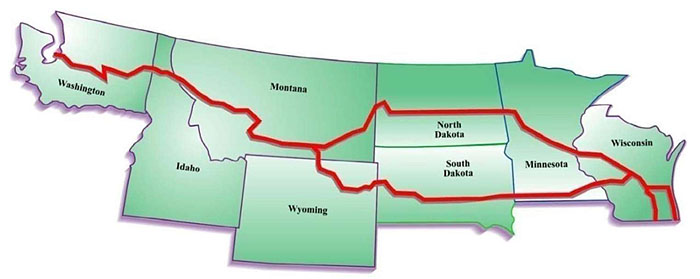
(Extended Text Description: This graphic is an illustration of the Northwest Passage Project, a multistate corridor coalition. The Northwest Passage extends from Wisconsin to Washington. A red line illustrates where traveler information and coordinate operations will be shared. From the east, the coalition begins in Wisconsin, forks and runs along two paths in Minnesota. The northern path in Minnesota continues through North Dakota and Montana, while the southern Minnesota path continues through South Dakota and Wyoming. The two paths meet in Montana, and continue through northern Idaho, and onto Washington State.)
Source: Western Transportation Institute
Author Notes for Slide 38:
The Northwest Passage extends from Wisconsin to Washington.
The corridor coalition is developing methods to share traveler information and coordinate operations across state and provincial borders.
The vision provides a framework to guide the states' future projects in the corridor.
Slide 39: Vision for the Future
Rural challenges unchanged over 50 years
ITS providing solutions to individual challenges at "hot spot" locations
Vision for ITS: INTEGRATION
- Institutional cooperation
- Information exchange
- Interoperability
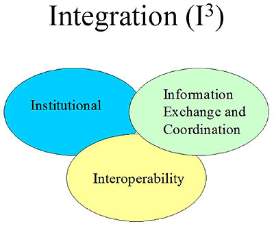
(Extended Text Description: This is an illustration for the Vision of ITS Integration identified as Integration (I3). In this illustration, there are three ovals that partially overlap. In the upper left is blue oval labeled "Institutional," the upper right is a green oval labeled "Information Exchange and Coordination." Below the blue and green ovals is a yellow oval labeled "Interoperability.")
Source: Western Transportation Institute
Author Notes for Slide 39:
The challenges faced by rural travelers and transportation agencies are largely the same as they were 50 years ago.
In the past 15 years, transportation researchers and practitioners have effectively deployed ITS systems to address targeted challenges.
In addition, regional and corridor initiatives have laid the foundation for strategic ITS deployments and integrated systems.
As rural ITS moves from "hot spot" applications to corridor and regional solutions, rural ITS can become more integrated and interoperable.
In other words, rural ITS can play a larger role in facilitating overall transportation agency planning and operations in rural areas.
Slide 40: Summary
Rural areas have unique challenges:
- Terrain, alignments, visibility
- Remote locations with severe weather
- Communication gaps, slow emergency response
- Obstacles - trucks, wildlife, recreational drivers
ITS technologies offer deployable solutions:
- Target one issue in single "hot spot" location
- Successful technologies
- Hazard warning systems, road weather systems
- Traveler information systems
- AVL, weigh-in-motion
Slide 41: Summary (continued)
Opportunities for regional coordination increasing:
- New technologies make integration easier
- Federal policy and funding encourages coordination
- Integrating ITS can facilitate data and resource sharing
Corridor coalitions are successful examples of regional coordination:
- State and local agencies work together on common challenges along interstate corridors
- Includes ITS deployments to address safety, traveler info, freight movement, and tourism
Slide 42: Summary (continued)
Source: Western Transportation Institute
Safe and efficient rural transportation is a key component of an effective and comprehensive national transportation system.
Slide 43: References
- AASHTO, 2003, "Strategic Highway Safety Plan: Rural Emergency Medical Services," http://safety.transportation.org/htmlguides/rural/section03.htm - content is no longer available.
- FHWA, 2006, Regional ITS Architecture Guidance Developing, Using, and Maintaining an ITS Architecture for Your Region, Report No. FHWA-HOP-06-112, https://ops.fhwa.dot.gov/publications/regitsarchguide/index.htm
- FHWA, 2011, "Highway Statistics 2011" (Highway Statistics Series), FHWA, Office of Highway Policy Information, https://www.fhwa.dot.gov/policyinformation/statistics/2011/pdf/hm220.pdf
- FHWA, 2012, "Planning for Transportation in Rural Areas," FHWA, Office of Planning, Environment and Realty, https://www.fhwa.dot.gov/planning/publications/rural_areas_planning/page03.cfm#IIDcfrtp
- National Highway Traffic Safety Administration, 2009, "Traffic Safety Facts, 2009 Data: Rural/Urban Comparison" (DOT HS 911 395), NHTSA National Center for Statistics and Analysis, Washington, DC, https://crashstats.nhtsa.dot.gov/Api/Public/ViewPublication/811395
- USDOT, 1997, "Advanced Rural Transportation Systems Strategic Plan," August 1997.
Slide 44: Questions?
- What are some of the unique challenges of rural transportation?
- What challenges can ITS help address in rural areas?
- What are two ITS technologies that have been successfully applied in a rural location?
- What are two potential benefits of regional ITS coordination?
- How do rural and regional transportation enhancements contribute to a comprehensive national transportation network?
Author Notes for Slide 44:
Answers:
- Road alignments/visibility, terrain, obstacles, trucks/slow vehicles, unfamiliar drivers, severe weather, communication gaps, slow emergency response, long distances between services, lack of alternative routes.
- ITS can help address or facilitate certain aspects of most challenges: safety, public transportation, infrastructure/maintenance, freight/commercial vehicle traffic, tourism, and sustainability.
- Examples include: automated warning systems for weather, obstacles, or traffic hazards; traveler information systems; weigh-in-motion sensors at truck weigh stations; emergency mayday systems; and automated vehicle location/tracking systems. (There are numerous correct answers to this question.)
- National policy and funding programs encourage and reward regional coordination. Integration of individual ITS technologies can facilitate region-wide data sharing and resource coordination.
- Transportation is key to economic vitality and growth. A complete and well-maintained rural network ensures that goods and services can reach every area of the country. Expedited transport from one urban area to another often relies on efficient travel through large rural regions.
Return to top ↑