
Safe Routes for All (SR4A)
Using AI-Based Image Recognition and Machine Learning Algorithms for Network-Wide Assessment and Routing of Multimodal Trips Based on Level of Traffic Stress
By: Kittelson & Associates
Project Objective & Overview
This SBIR Phase I project leveraged artificial intelligence (AI) and machine learning (ML) to transform how agencies assess and improve bicycle and pedestrian infrastructure. The project addressed critical data gaps in Complete Streets planning by:
- Automating extraction of infrastructure features from aerial imagery using computer vision
- Developing comprehensive Level of Traffic Stress (LTS) assessments for both street segments and intersections/crossings
- Creating personalized routing algorithms that account for cyclist level of comfort preferences
- Demonstrating proof-of-concept in Tampa, FL with 21,136 images
This innovative approach reduces data collection costs, standardizes Level of Traffic Stress (LTS) measurements across jurisdictions, and provides insights for infrastructure investment decisions.
Key Results & Findings
Successfully extracted 5 infrastructure features from imagery:
- Roads, sidewalks, crosswalks, bike facilities, and parking
- Achieved accurate detection even with obstructions (trees, buildings)
- Developed methods to measure geometric features from pixel data
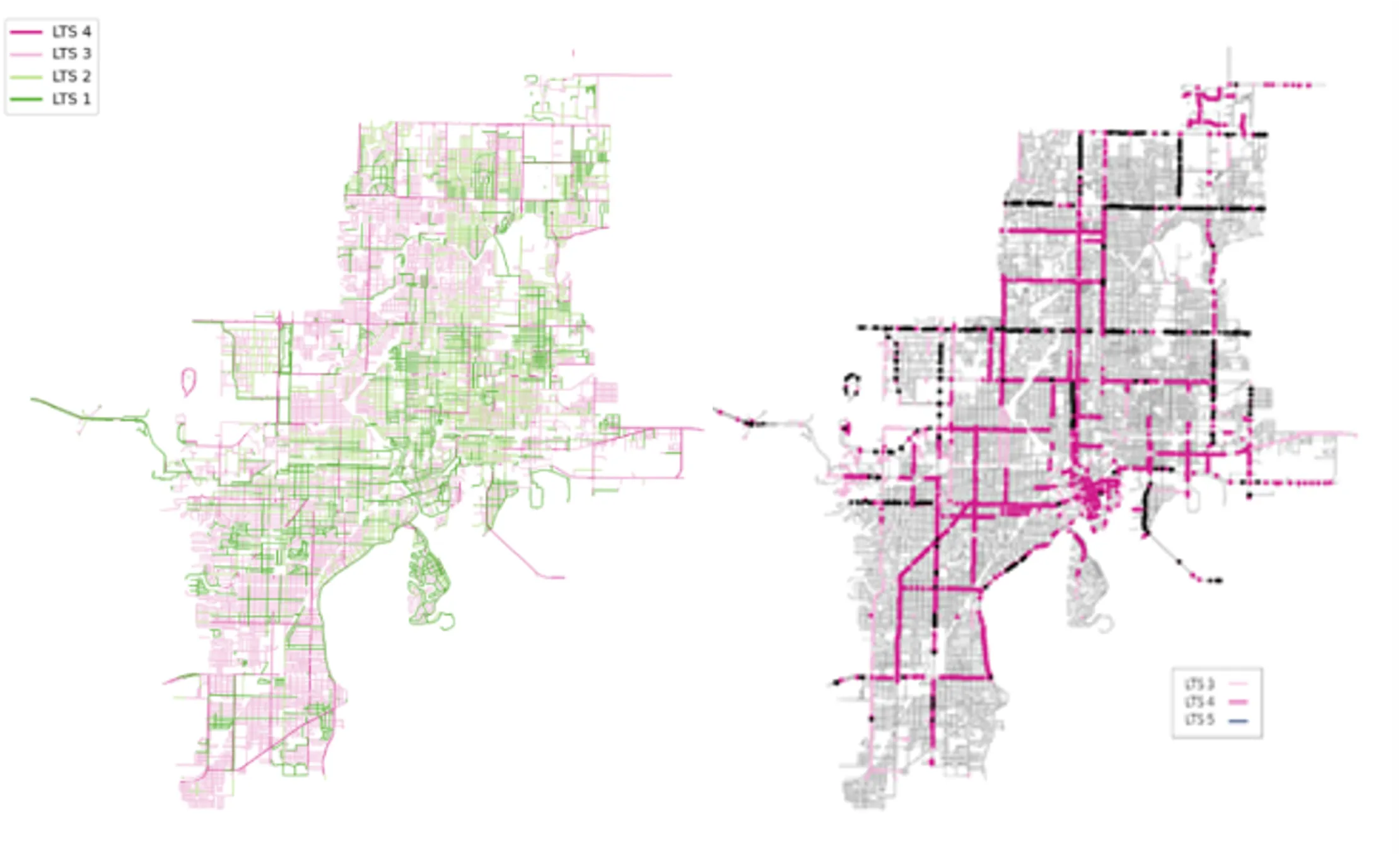
Advanced LTS methodology:
- Incorporated movements into LTS calculations (major gap in current methods)
- Created crossing-level stress assessments to complement segment analysis
Personalized routing algorithm:
- Accounts for 4 cyclist comfort levels (Direct, Strong & Fearless, Enthusiast & Confident, Interested but Concerned)
- Outperformed commercial routing for low-stress bicycle trips
- Balances distance, time, and stress factors
Created comprehensive Tampa dataset demonstrating scalability and real-world application
Company Info
Kittelson and Associates is a transportation engineering and planning firm with 25+ offices across the US. Our team has expertise in Complete Streets and Level of Traffic Stress analysis (authored key NCHRP reports), AI/ML and computer vision applications, Web-based transportation planning tools, and data analytics and visualization.
Website: www.kittelson.com
Project POC: Bastian Schroeder, PhD, PE
Email: bschroeder@kittelson.com
Next Steps
- Develop user-friendly web-based tool integrating all Phase I algorithms
- Scale methodology to additional cities nationwide
- Enhance model accuracy and feature detection
- Create dual-access model: Free base version for public agencies + commercial professional version with advanced analytics