Transportation Data Exchange Initiative
Improving travel experiences through open transportation data exchange
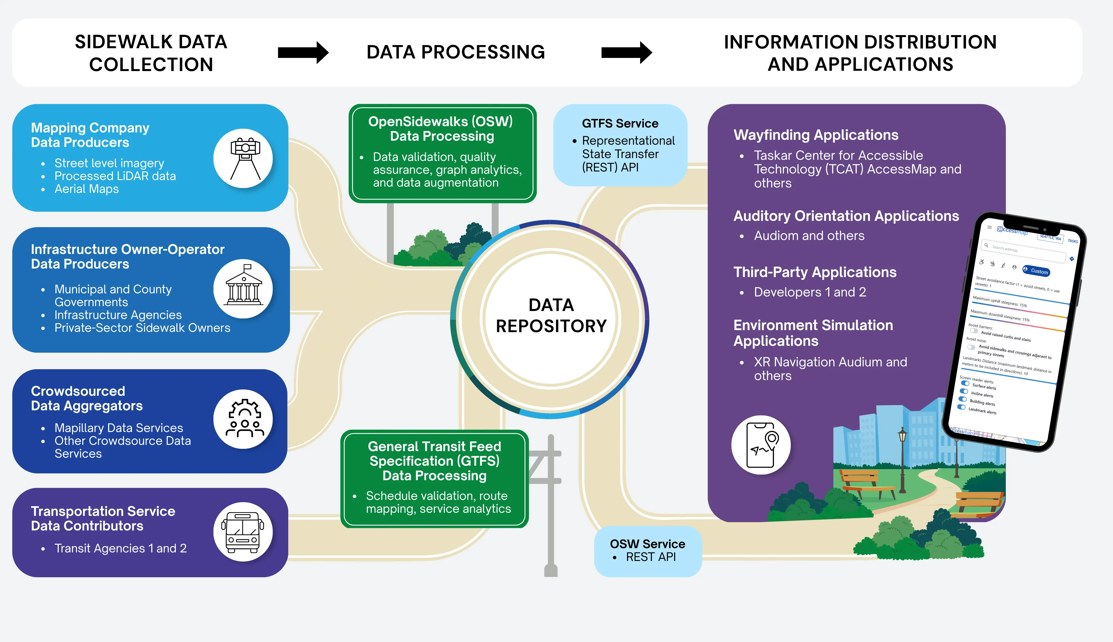
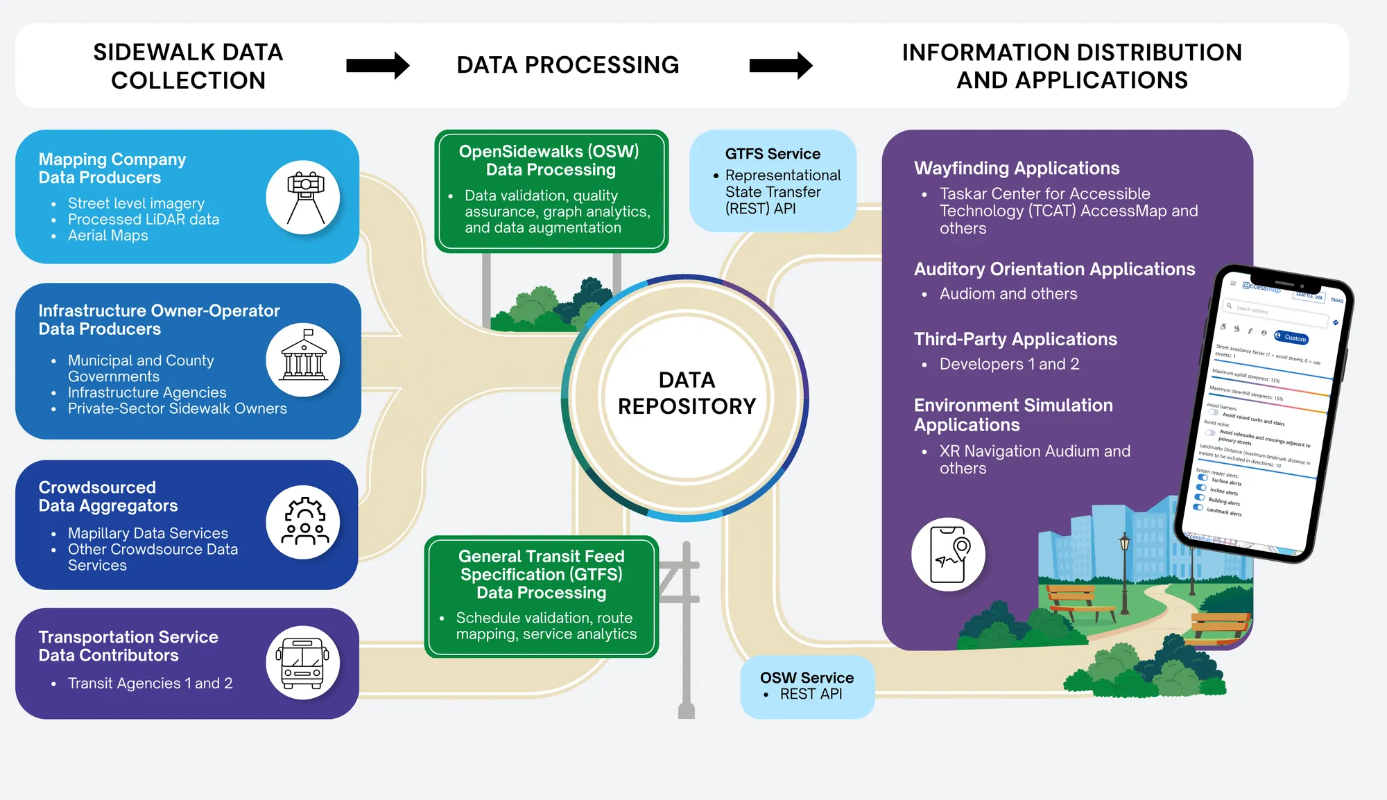
The University of Washington's Transportation Data Exchange Initiative (TDEI) is improving the quality, efficiency and interoperability of transportation services by standardizing how transportation data is structured and shared. This approach is being used in Washington, Oregon, and Maryland.
How it Works
Features and Benefits
- Enhance Data Standards — Include information relevant to all travelers and transit stakeholders.
- Provide Tools and Data Infrastructure — Reduces barriers for data stewards to collect, vet, maintain and use traveler-centric transportation data at scale.
- Private/Public Partnerships — Demonstrates work through pilot data collections.
- Updating International Data Standards — OpenSidewalks Schema, GTFS-Flex, and GTFS-Pathways.
- Data Governance Groups — Working to update and refine standards to address open exchange in transportation data.
- Walkshed Analysis Tool — Quantify and analyze access to/from a point with detailed statistics on accessible community resources, accessibility barriers and other measures.
- AccessMap Multimodal — A trip planner that allows users to express sidewalk preferences and receive suitable paths via mapped infrastructure.